News

How SYTIS Prevent Accidents - Substation Fire Near Heathrow Airport
On May 20th, a fire broke out at a substation in Hayes, London, disrupting operations at Heathrow Airport and cutting power to tens of thousands of homes. According to AP News, the blaze was caused by a transformer with 250,000...
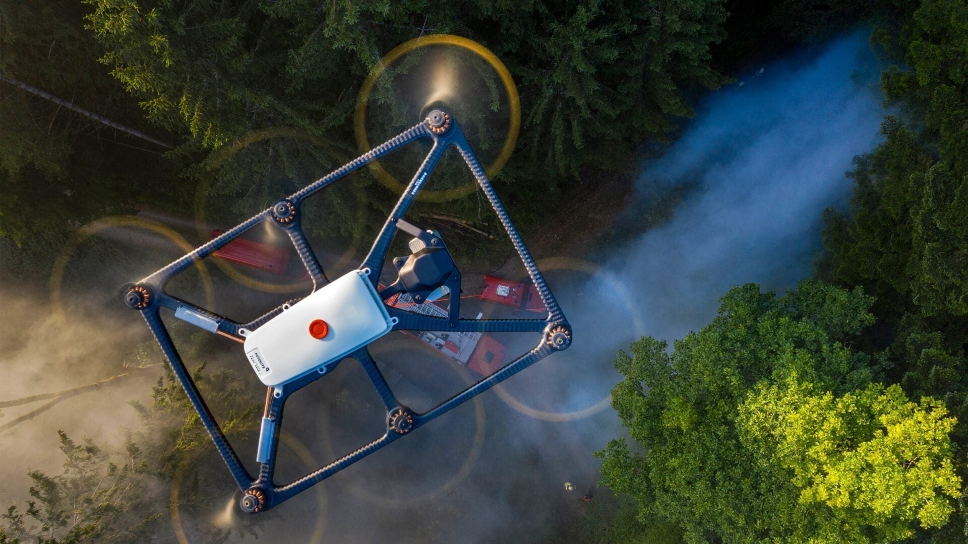
Elevate Your Mission: The Proven Power of the Fotokite Sigma
At AlphaGeo, we understand that professionals in public safety and critical infrastructure demand technology they can trust. The Fotokite Sigma tethered drone is not just a piece of equipment; it's a proven asset that delivers real-time, aerial situational awareness when it...
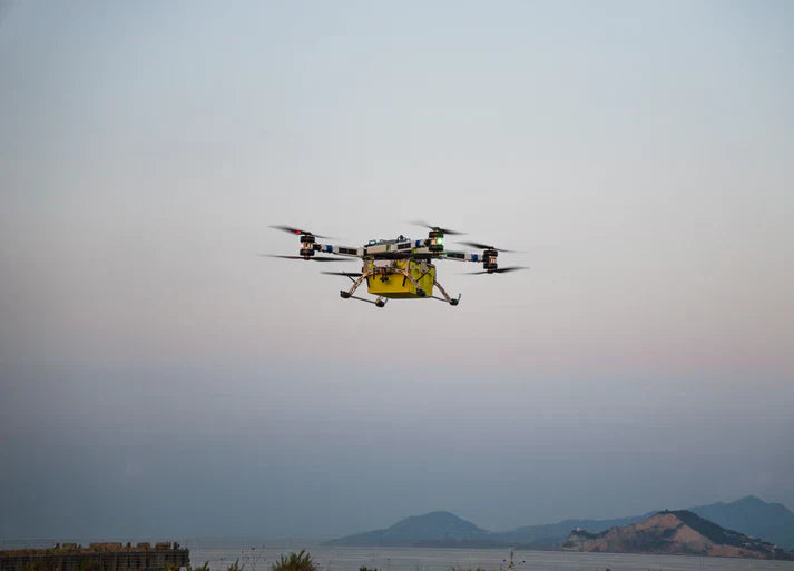
Revolutionising Heavy-Lift Logistics: Introducing FlyingBasket Drones
At AlphaGeo, we're dedicated to bringing the most advanced and efficient drone solutions to our clients across surveying, inspection, and various industrial applications. We are thrilled to highlight FlyingBasket, a pioneer in the heavy-lift cargo drone market, and their impressive...
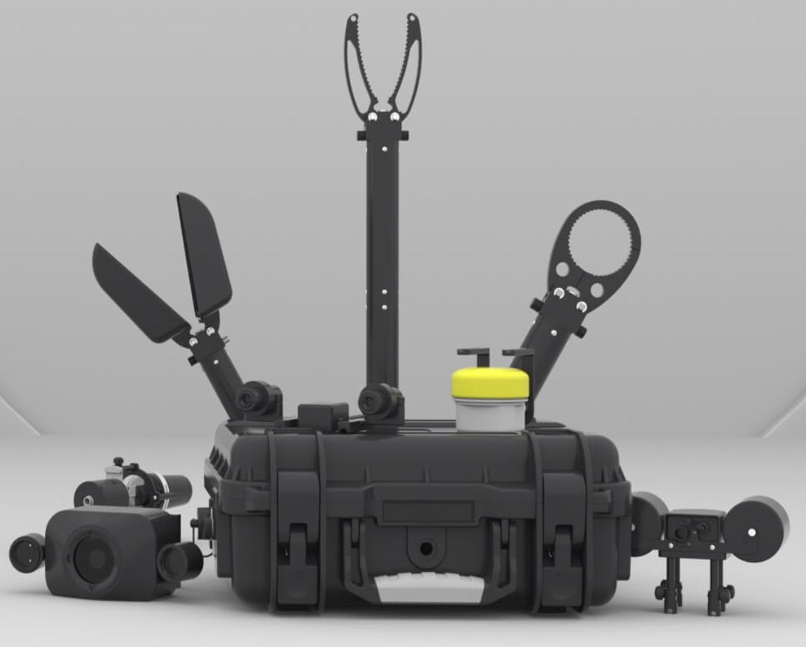
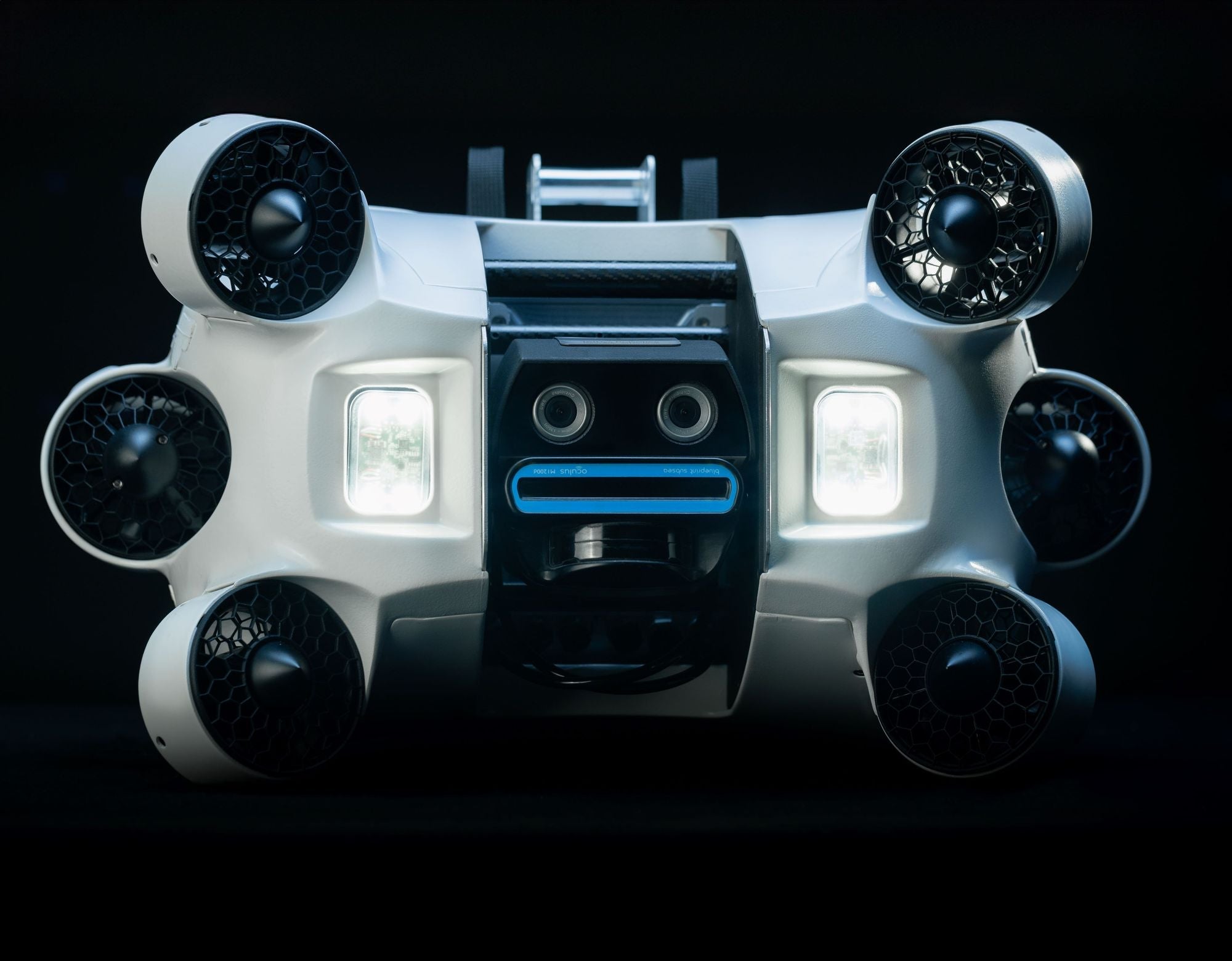
What Exactly Is An ROV Payload & How Can They Be Used?
When we talk about Remotely Operated Vehicles (ROVs), the true magic often lies not just in the vehicle itself, but in the incredible "payload" it carries. Think of the ROV as a fearless explorer, and its payload as its carefully...

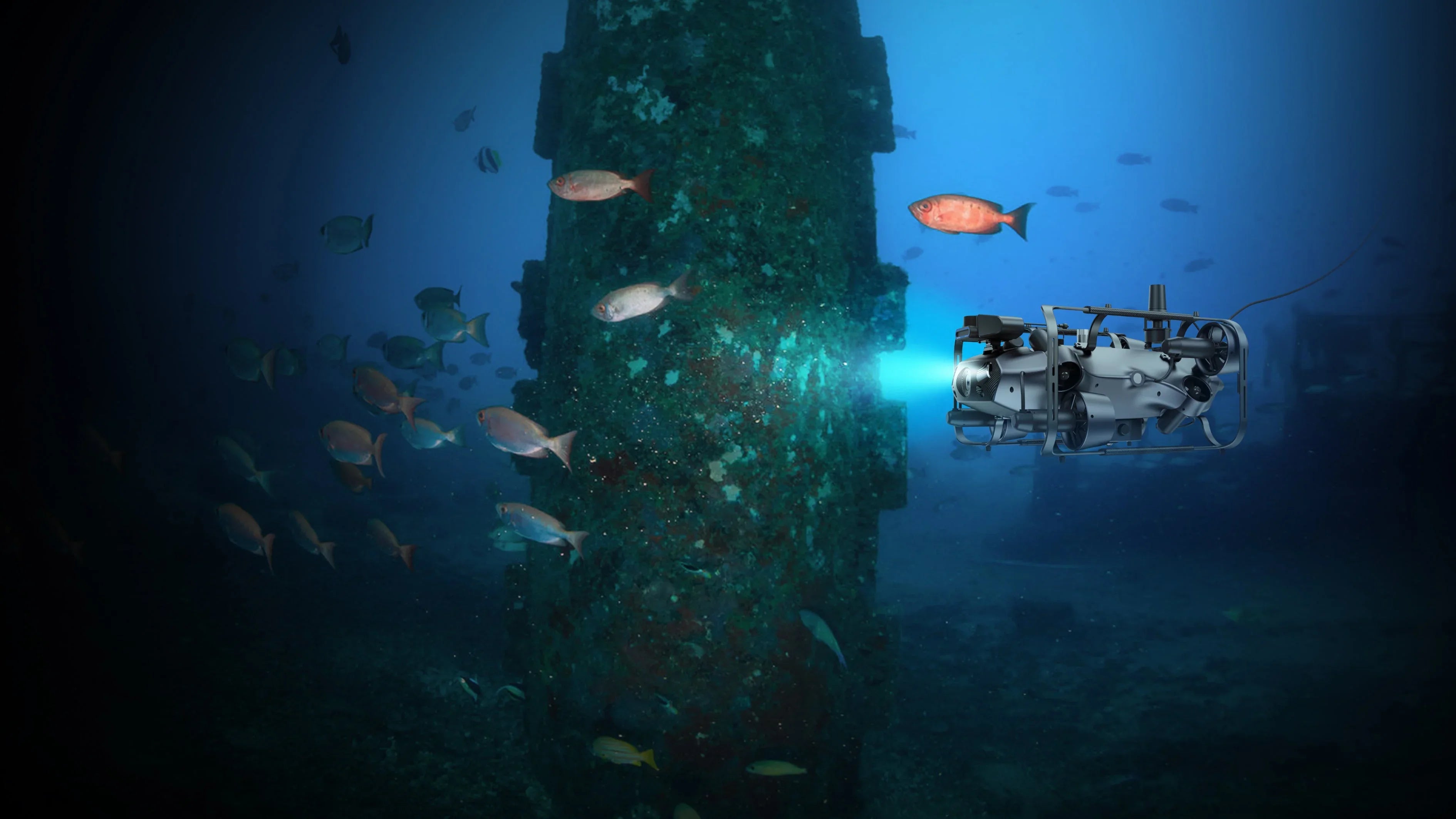
Revolutionising Hull Inspections with CHASING ROVs
At AlphaGeo, we continually seek innovative solutions to enhance efficiency, safety, and cost-effectiveness across various industries. That's why we're thrilled to highlight the CHASING Underwater ROV series – a suite of cutting-edge industrial-grade underwater robots specifically designed to transform hull...
Introducing The New Tethys ONE ROV/AUV Hybrid for Automated Underwater Inspections
Revolutionising Underwater Inspections: Introducing the Tethys One At AlphaGeo, we are committed to bringing you the most cutting-edge solutions for your geospatial and inspection needs. That's why we're incredibly excited to announce the arrival of the Tethys One, a ground-breaking...
Why the Chasing M2 Underwater Drone Range is Changing Subsea Inspections
Explore the power, precision, and portability of Chasing ROVs from AlphaGeo UK In the fast-evolving world of subsea inspection and data collection, Chasing ROVs are setting new standards for versatility and affordability. At AlphaGeo UK, we specialise in cutting-edge underwater...
Discover AlphaGeo: Your Trusted Partner in Geospatial Tech
Welcome to AlphaGeo – the UK’s go-to specialist for surveying equipment, UAVs, ROVs, software, and expert support services. Whether you're an environmental professional, surveyor, inspection engineer or drone enthusiast, you can now easily buy online with confidence and trust in our...
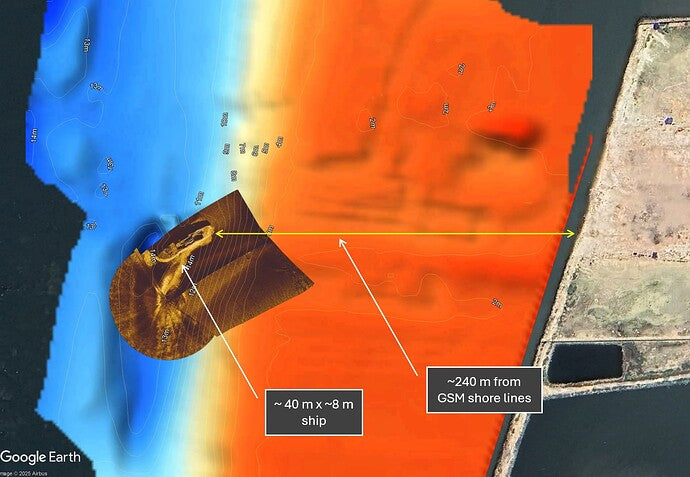
Shipwreck Discovery off the Coast of Madura Island, Indonesia
During a bathymetric survey in the coastal waters of Madura Island, East Java, Indonesia, we discovered a previously undocumented shipwreck measuring approximately 40 x 8 meters. The discovery was made around 240 meters offshore, directly in front of our survey...