YellowScan Navigator: Bathymetric UAV LiDAR
YellowScan Navigator: Bathymetric UAV LiDAR
Enquire for Prices and Availability - Secure Yours Now
Share Product
- Free UK Delivery (Orders Over £100)
- Price Checked (Best Price Guarantee)
- UK Based (Approved Dealer)
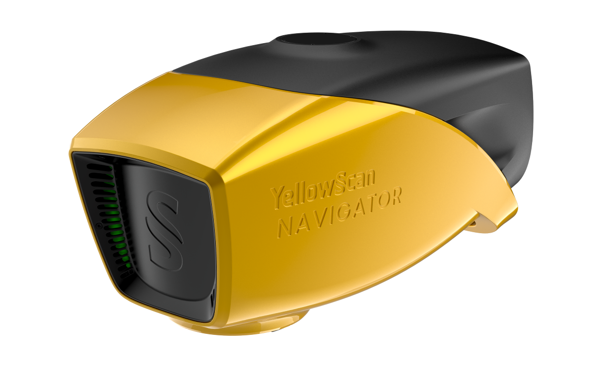
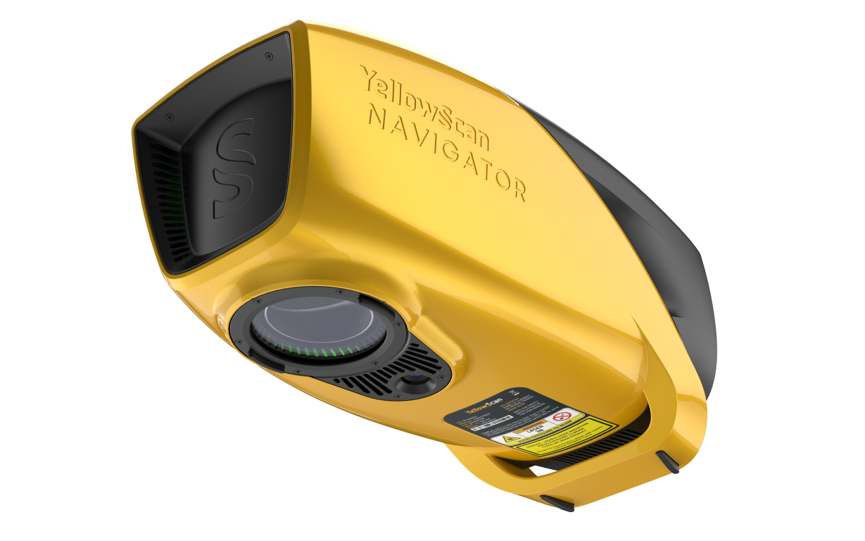
YellowScan Navigator bathymetric LiDAR is an innovative solution for exploring underwater and ground topography with a single-button operation.
Its lightweight design allows for versatile platform selection without compromising water penetration.
Depths to heights: operating bathymetric LiDAR with one button
AGL Altitude: Up to 100m (330ft)Ideal for: Its compact design allows for operating on various UAV platforms without compromising water penetration. Survey shorelines, rivers or ponds with ease, by getting simultaneous land and underwater topography
Ideal for:
Hydrographic surveys
Inter coastal
Wind farm
Seabed's
Last KM survey up to and including beach / shoreline Flood
Risk modelling
Tech Spec
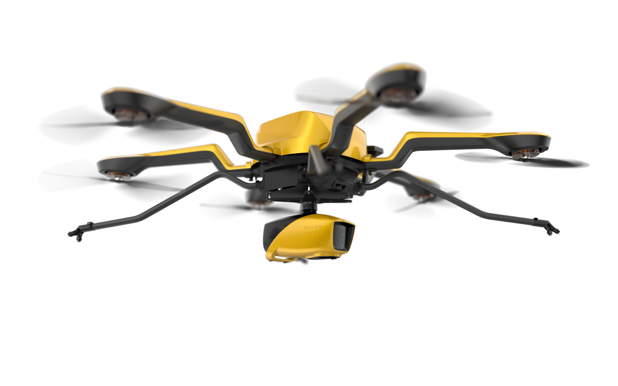
Multi-platform adaptability: This system can be used on multirotor or helicopter UAVs. When it comes to drones, the “quick release” GREMSY attachment allows for easy mounting on a wide range of drones.
Simultaneous land & water survey: The YellowScan Bathymetric system is designed for conducting bathymetric measurements in shallow waters and is rapidly deployable on a UAV. This full waveform LiDAR system ensures continuity between underwater points and the surrounding terrain.
Diverse water environments: Intended for aerial use on drones, the system covers various water areas such as shorelines, rivers, lakes, estuaries, ponds and gravel pits. Navigator is user-friendly and adaptable for a wide range of applications, from hydrographic surveys to underwater resource management.
44° FOV for high precision: Our bathymetric system, with a 44-degree field of view, prioritizes precision over a broader angle. This decision is based on the fact that 44° is the maximum angle for a green laser to perform effectively underwater. Beyond this angle, the laser’s penetration depth in water is significantly affected, limiting the system’s overall performance.
High autonomy for maximized efficiency: Optimize your bathymetric survey operations with our LiDAR system, delivering a 45-minute autonomy on a single battery charge for extended underwater data collection in various marine settings.
Delivery
Delivery
Free UK Delivery Over £100 (£8 if under)
Pre-Order Only - Allow 4-6 weeks For Delivery
Free Demo Or More Info: Contact Us Now
Finance
Finance
Finance available on this product - Simple and low cost. For more information Click Here
What can we help you with today?
-
Rental Options
Product Rental -
Request a Demo
Get a Demo -
Ask a Question?
Contact Us
