KickTheMap HaX 2.0 RTK
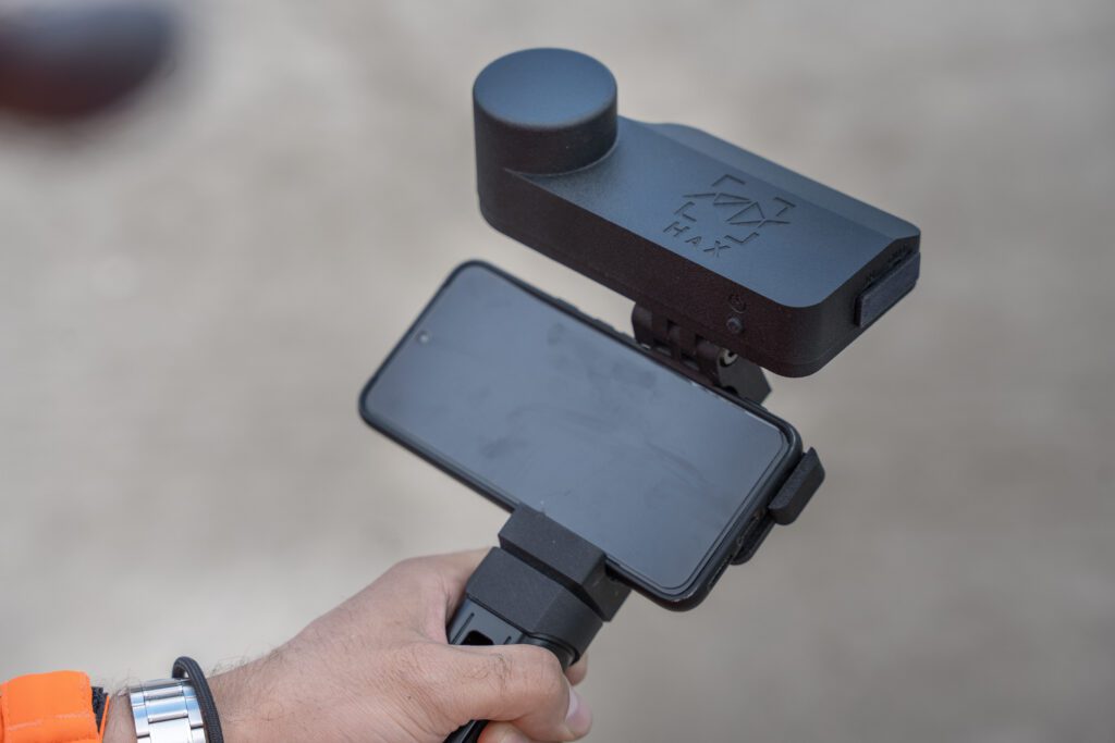
Next-Generation GNSS Precision – HaX RTK 2.0 delivers centimetre-level accuracy for utilities, surveying, and infrastructure projects with effortless 3D mapping integration.
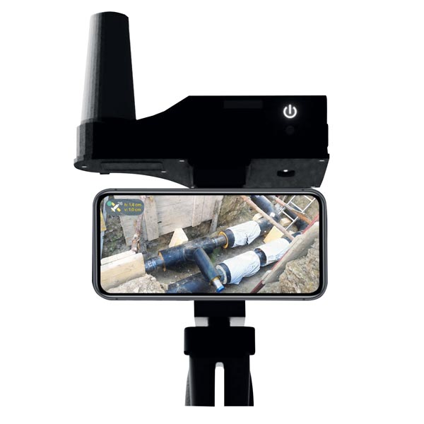
Seamless KickTheMap Integration – Connects directly with the KickTheMap app to georeference images and LiDAR data automatically—no photogrammetry skills required.
Efficient, Field-Ready Workflow – Capture, process, and map in real time with lightweight data output, reducing processing time and improving on-site productivity.
Need Support Financing The Product?
Simple and low cost finance available on this product. For more information click here.
Looking For A Free Demo?
If your seeking a free demo of the product before you buy please click here.
Want To Rent This Product?
Rental plans are also available for this product. To learn more click here.
Free UK Delivery - Orders Over £100
Enjoy our high-quality products and get free UK delivery on orders over £100. For smaller orders, it's just an £8 flat rate.
Price Checked - Best Price Guarantee
Enjoy the best prices guaranteed on all our products. Shop confidently knowing you're getting unbeatable deals.
UK Based - Approved Dealer
Discover a wide selection of premium UK-based products from our approved dealership. Trust in over a decade of expertise.
Product details
Product Info
Key Features
Delivery Details
Free UK Delivery is available on all orders over £100.
Orders under £100 have a fixed delivery price of £8.
Delivery takes around 4-5 weeks to most UK addresses, except for in stock items, as below.
In-Stock Items Only - Delivery will be made in 2-3 working days. Next Day Delivery is also available to UK mainland addresses for £30 per order, order By 12pm, Mon to Fri to receive next day.
Conditions - Some locations outside mainland UK may incur additional charges, which are representative of the extra cost that we get charged by the courier. Delivery is available to Europe and some Worldwide locations. Contact us directly on sales@alphageouk.com if you need any help or have questions, before you order.
If you have any questions, please ask them using our live chat for immediate answers or you are always welcome to use our Contact Us form. We'll get back to you as soon as possible.
-
Shipping Information
Use this text to answer questions in as much detail as possible for your customers.
-
Customer Support
Use this text to answer questions in as much detail as possible for your customers.
-
FAQ’s
Use this text to answer questions in as much detail as possible for your customers.
-
Contact Us
Use this text to answer questions in as much detail as possible for your customers.
FAQs
Please read our FAQs page to find out more.
What does each product package include?
Each listing clearly states what’s included in the box (e.g. main unit, batteries, charger, cables, software license, spare parts, accessories). If you’re unsure, check the “Package Comparison” section of the product page or contact us for confirmation before purchase.
How long does delivery take, and when will my order ship?
- UK Standard Products: 4-5 weeks
- In Stock products: 2-3 business days
- Orders placed before 2 pm (weekdays) are dispatched the same day when in stock.
- Free UK delivery is available for orders over £100.
What warranty and support do you offer?
- Every product comes with a 12-month warranty covering manufacturing defects under normal use.
- During the warranty, we provide repairs or replacement of faulty parts, as well as technical support.
- After the warranty period, we continue to offer repair, servicing, and parts support.
- Our UK repair centre handles original parts and full testing.
Can I get a demonstration, training or customized solution?
Yes - we offer product demonstrations (in person or virtually), webinars, and one-on-one training to help you get up to speed. We also custom-configure or adapt solutions (e.g. integrating sensors, payloads, alternate configurations) to suit your specific project needs.
