
🌟 Transforming Aerial Surveys: Advanced Drone Integration 🌟
📅 Join AlphaGeo & SPH Engineering for an exclusive webinar!
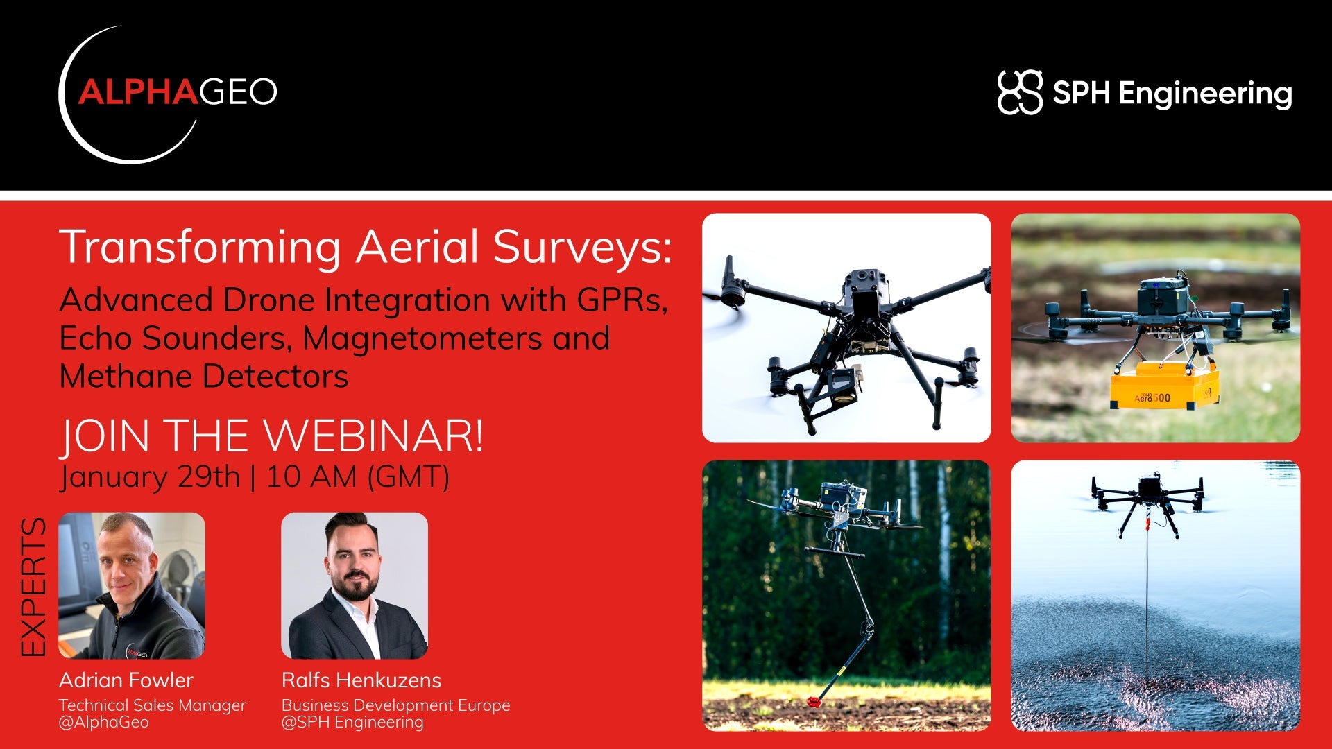
🚀 What will you learn?
Discover how drones are revolutionizing geophysical surveys. In this webinar, we’ll cover:
🔍 Subsurface detection techniques
📊 Magnetic data acquisition
🌊 Airborne bathymetry
💨 Remote methane leak detectionTake your geophysical survey capabilities to new heights with advanced drone integration!
👥 Who is this for?
This webinar is ideal for:
✅ Companies using traditional geophysical tools (terrestrial, handheld, etc.)
✅ Surveyors looking for innovative solutions
✅ Drone operators ready to enhance their services
✅ Construction & engineering professionals
✅ Academic researchers seeking advanced methodologies🙅 Who is this not for?
If your focus is solely on aerial inspections or general photogrammetry without plans to diversify—this might not be your match. But we’d still love for you to explore the potential!📅 Don’t miss out—register now:
👉 Register HereLet’s transform your approach to surveying!
#Drones #Geophysics #Surveying #Innovation #Technology #Webinar #AlphaGeo
Share:
Unlock 3D Modeling with CHASING Underwater ROV
Hyperspectral vs. Multispectral Imaging: A Deep Dive into Cutting-Edge Optical Technologies